 HiPoTeSis approved by Interreg Atlantic Area: strengthening floating offshore wind test infrastructure across Europe
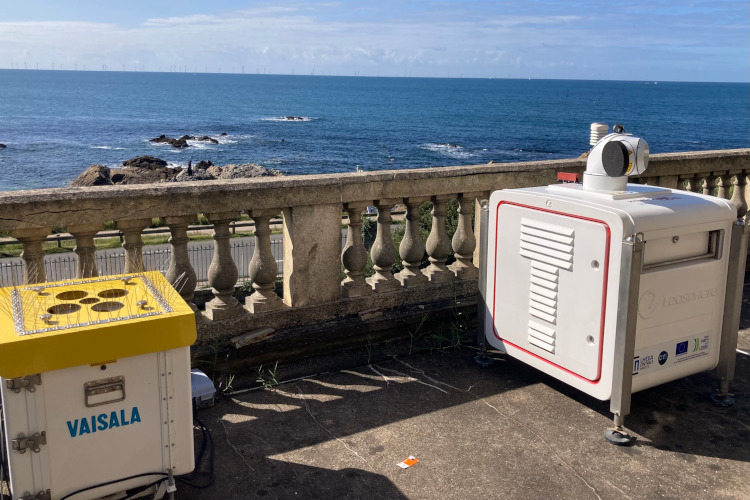
A new campaign has begun with the reinstallation of the LHEEA’s scanning LiDAR on the OPEN-C Foundation’s office terrace in Le Croisic for 1 month. This innovative device, which had already proved its effectiveness during a 1st campaign on the terrace in 2020 and then at sea in 2022, enables essential data to be acquired on the offshore wind resource.
Boris Conan, Senior Research Fellow at the Laboratoire d'Hydrodynamique, Energétique et Environnement Atmosphérique (LHEEA) at Centrale Nantes and CNRS, explains:
“For our research at LHEEA on the characterization of offshore wind resources, it's an ideal situation to be able to install LiDAR on this site. The SEM-REV, created by Centrale Nantes and now operated by the OPEN-C Foundation, gives us the opportunity to carry out our field measurements as close as possible to offshore wind conditions. It's a great opportunity to advance our knowledge and the development of such measurement tools”.
Why are these measurements important?
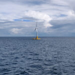
The objective of LiDAR scanning is to collect data on the wind, and in particular on the wake of a floating wind turbine. These wakes (wind disturbances caused by the passage of air around the blades of a wind turbine) need to be accurately measured in order to better understand the interactions between wind turbines, with a view to optimizing the production of future floating wind farms.
An innovative optical measurement tool
LiDAR (Light Detection and Ranging) is a cutting-edge optical instrument used to characterize wind at different heights in the atmosphere. For this campaign conducted by the OPEN-C Foundation and the LHEEA, a reference LiDAR profiler will be used to compare the measurement performance of the scanning LiDAR in RHI scan configurations (vertical measurement slices), whereas the previous campaign used PPI (horizontal measurement slices). The medium-term objective is to be able to deploy it at sea on floating wind farms.
This research is being carried out as part of the France Atlantique project, for the forthcoming installation of EOLINK's floating wind turbine on the SEM-REV site, created by Centrale Nantes and operated by the OPEN-C Foundation since 2023.
This project is financially supported by ADEME and the France 2030 Program.
Find out more about previous campaigns:
First successful offshore campaign for the stabilised scanning LiDAR - LHEEA (ec-nantes.fr)
First LiDAR measurement campaign underway at Penn-Avel - LHEEA (ec-nantes.fr)
